After days of relentless downpours soaking the capital, Londoners are finally seeing a break in the rain-just as a fresh weather threat looms over much of the UK. Forecasters have issued new snow and ice warnings, signalling a sharp turn from sodden streets to perhaps treacherous conditions on roads and pavements. The Met Office alerts cover large swathes of the country, raising the risk of travel disruption, power interruptions and hazardous commutes, even as the skies over London begin to clear. This shift in the weather pattern marks a turbulent transition from autumn’s deluge to the first serious wintry spell of the season.
Met Office issues widespread snow and ice alerts as cold snap grips the UK
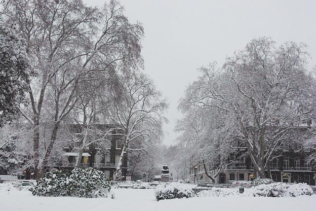
Forecasters have placed large swathes of the country under yellow weather alerts as Arctic air drives temperatures below freezing and turns previously sodden streets into treacherous surfaces. The warnings extend from the Scottish Highlands down through northern England and into parts of the Midlands and the South West, with London and the South East facing particular risk from black ice as days of persistent rain give way to overnight frost. Commuters are being urged to allow extra travel time, while councils race to deploy gritters on key routes and rail operators warn of possible delays due to frozen points and signalling problems.
- Hazards: Icy roads, pavements and untreated cycle lanes
- Transport impact: Slower journeys, minor rail disruptions, local bus diversions
- Health concerns: Increased risk of slips, trips and cold-related illnesses
- Timing: Sharpest conditions expected during late night and early morning hours
| Region | Alert Level | Key Risk |
|---|---|---|
| London & South East | Yellow | Ice on wet surfaces |
| Midlands | Yellow | Snow showers, rural disruption |
| Northern England | Yellow | Hill snow, icy patches |
| Scotland | Yellow | Accumulating snow, blizzards on routes |
Emergency planners are closely monitoring conditions as colder air continues to undercut lingering bands of moisture, creating a volatile mix of snow flurries and freezing rain in some districts. Vulnerable residents are being advised to keep homes heated to safe levels and check on neighbours,while motorists are reminded to carry winter essentials such as de-icer,blankets and fully charged phones. Even though accumulations in the capital itself are expected to be light,forecasters warn that even a thin film of ice could prove highly disruptive on already fatigued infrastructure,with the public urged to heed official advice and avoid unnecessary journeys during the most hazardous periods.
How easing London rainfall could heighten risks of black ice and travel disruption
As the long spell of drizzle and downpours finally eases over the capital, forecasters warn that London’s saturated streets are primed for a rapid freeze. What has been a protective blanket of rain can quickly turn into an invisible hazard once temperatures dip, with standing water and damp road surfaces crystallising into thin, transparent sheets of black ice.Unlike freshly fallen snow, this glaze is almost impossible for drivers and pedestrians to spot, particularly on poorly lit residential roads, cycle lanes and exposed rail platforms. Transport planners say it is indeed this “now you see it, now you don’t” transition that turns a welcome break from rain into a fresh test for commuters and emergency services.
Officials are advising Londoners to prepare for abrupt changes in travel conditions overnight and during the early rush hour, when surface temperatures are expected to fall fastest. Key danger zones include:
- Bridges and flyovers that cool more quickly than surrounding roads
- Bus routes on hills and tight corners, where braking distances lengthen
- Railway points and platforms, vulnerable to ice build-up and slipping hazards
- Cycle superhighways, where thin ice can form along gutter lines and painted surfaces
| Time window | Risk level | Travel advice |
|---|---|---|
| Late evening | Moderate | Check gritting routes, avoid non‑essential drives |
| Early morning | High | Allow extra journey time, reduce speed, wear non‑slip footwear |
| Mid‑morning | Lowering | Remain cautious in shaded streets and on side roads |
What commuters and motorists should do now to stay safe in freezing morning conditions
As thermometers sink below zero on key commuter routes, journeys that once felt routine now demand a tactical rethink. Transport chiefs urge Londoners to plan earlier, move slower and dress smarter, with particular attention to the treacherous “black ice hour” just before and after dawn. Rail and Tube users should factor in slower services and sudden timetable changes, checking live updates before leaving home, while cyclists are being advised to swap speed for stability, lowering tire pressure slightly and avoiding painted road markings, which become slick glass in sub-zero conditions.
- Leave extra time: Aim to set off at least 20-30 minutes earlier than usual.
- Layer up: Thermal base layers, gloves and windproof outerwear reduce cold-related distraction.
- Check your route: Use live travel apps for delays, diversions and temporary speed restrictions.
- See and be seen: High-visibility clothing and strong bike or car lights are essential in dim, icy dawn light.
| For Drivers | For Public Transport Users |
|---|---|
| Clear all windows and mirrors, not just a peephole. | Check service status before leaving; expect platform crowding. |
| Use gentle acceleration and braking; double your usual stopping distance. | Wear non-slip footwear for icy station steps and pavements. |
| Stick to main roads, which are more likely to be gritted. | Carry a spare layer in case of delays on exposed platforms. |
Motoring organisations stress that planning now will prevent breakdowns at the coldest, busiest point of the day. That means keeping de-icer, an ice scraper and a blanket in the car, plus a fully charged phone and power bank. Tyre pressures should be checked weekly in this snap,while fuel tanks are best kept at least half full to avoid condensation-related issues. Above all, anyone heading out before sunrise is being urged to adjust expectations: shorter, slower trips, with more space between vehicles, could be the difference between a routine commute and an avoidable collision.
- Reduce speed: Drive below the limit when surfaces might potentially be frozen.
- Increase distance: Leave at least a four-second gap to the vehicle in front.
- Avoid sudden moves: Steer, brake and accelerate smoothly to maintain grip.
- Know when to stay home: If conditions deteriorate sharply, employers are being encouraged to accept remote working where possible.
Why councils and transport operators face mounting pressure over gritting and winter readiness
As forecasts shift from relentless London downpours to sub-zero alerts, local authorities and transport operators are being scrutinised more closely than ever. Years of tight budgets collide with rising public expectations,creating a fraught balancing act between cost and safety. Residents now track gritting lorries in real time, compare council responses on social media and question why one borough’s pavements sparkle with salt while the next street over turns into a skating rink. Operators running buses, trains and trams face similar questions when early-morning services are curtailed or cancelled, with passengers demanding to know whether enough was done overnight to keep networks moving.
This intensified focus is driven by a combination of climate volatility and political accountability. Winters are no longer reliably harsh or mild, making it harder to justify large reserves of salt, specialist kit and standby crews that may sit unused for weeks-until a single cold snap exposes any weakness. At the same time, ministers and councillors are under pressure to prove that lessons from past cold-weather chaos have been learned. That means clearer plans, faster communication and more visible action:
- Transparent gritting routes published in advance for key roads and bus corridors
- Real-time service updates across apps, station screens and social media
- Priority pavements and cycleways near schools, hospitals and major interchanges
- Joint councils-operators control rooms during Met Office weather warnings
| Challenge | Impact on Public | What’s Expected Now |
|---|---|---|
| Limited gritting budgets | Patchy road and pavement safety | Clear criteria for which routes get treated |
| Staff shortages | Slower response at peak travel times | Visible winter staffing plans and backup crews |
| Confusing updates | Passengers stranded or delayed | Simple, consistent messaging across channels |
Final Thoughts
As the capital emerges from days of relentless rain, the Met Office’s latest alerts are a clear reminder that winter’s grip is far from over. With snow and ice warnings now stretching across large parts of the UK, forecasters are urging caution on the roads and pavements, and advising travellers to check conditions before setting out.
London may have swapped driving downpours for drier skies, but temperatures are set to edge lower and further unsettled weather remains likely in the days ahead.Commuters, households and businesses alike are being told to stay prepared for disruption, follow the latest guidance, and keep a close eye on updates as this cold snap develops.